Maps of the Heavens and the Earth
Author: Willem Goeree 1635-1711
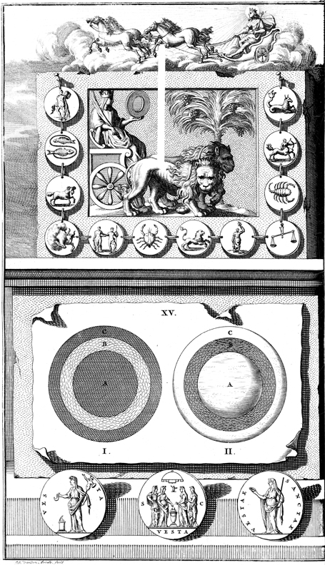
Image Title: Maps of the Heavens and the Earth
Description: Ancient conceptions of the measurement and divisions of the sky. Apollo rides his chariot over representations of the twelve signs of the Zodiac (top); diagrams of the earth over three coins depicting Vesta, the Roman goddess of hearth and home, who also represented Earth, the sacred sphere that makes life possible. Engraved by Jan van den Aveelen (1655-1727).
Click here for additional images available from this book.
Request a high-resolution file (fees apply)
Rights Statement: The online edition of this work in the public domain, i.e., not protected by copyright, has been produced by Pitts Theology Library, Emory University.
Rights Status: No Copyright - United States
Pitts Theology Library provides copyright information as a courtesy and makes no representation about copyright or other legal status of materials in the Digital Image Archive.